Overview
Tanzania is an independent sovereign state located in Africa, specifically within the Eastern Africa subregion. It covers approximately 947,303 km² and is home to an estimated 68,153,004 people. The country has coastline along international waters, which has shaped its trade routes, climate, cuisine, and cultural exchanges with the rest of the world. Its capital is Dodoma, which serves as the political and (in most cases) economic centre of the country, hosting the seat of government and the principal international airport.
This profile pulls together the structured facts that most readers want at a glance — capital, currency, languages, borders — and links onward to the maps and neighbouring countries you are likely to need next. Every figure on this page is rendered server-side from a single dataset, so what you see here matches the regional indexes, statistics rankings, and continental hubs elsewhere on MapVista.
For travellers, students, journalists, and the merely curious, the goal is simple: a single readable page per country that answers the questions you actually asked, without redirecting you to a sign-up screen or a paywall. Citizens of Tanzania are commonly described as Tanzanian, a demonym you will encounter in news coverage and academic writing alike.
Geography & borders
Tanzania is a mid-sized country, covering approximately 947,303 km² of land in Africa (specifically the Eastern Africa subregion). The country has coastline along international waters, which has shaped its trade routes, climate, and cultural exchanges with the rest of the world. Its approximate geographic centre lies at 6.00° S, 35.00° E, placing it in the southern hemisphere on a line with several other Eastern Africa nations. Tanzania shares land borders with 8 neighbouring states, a typical configuration for Eastern Africa which makes overland travel and cross-border trade central to daily life.
Bordering countries
Tanzania shares land borders with the following 8 neighbours. Each one links to its own full profile so you can hop around the region without losing your bearings:
Live map
Map data © OpenStreetMap contributors, ODbL. · Open in OpenStreetMap · Open in Google Maps
People, demographics & density
With an estimated 68,153,004 residents, Tanzania is a populous country. That works out to roughly 71.9 people per square kilometre, a moderate density with substantial open countryside between population centres. The capital, Dodoma, anchors the country's political and often economic life and is usually the first city most international visitors encounter. Citizens of Tanzania are commonly described as Tanzanian.
Compared with the global mean of roughly 60 people per square kilometre, Tanzania's figure of 71.9 people / km² places it around the global average — a comfortable mix of urban centres and open countryside.
Languages, currency & culture
Culturally, English and Swahili share official status in Tanzania, while Tanzanian shilling (TZS) is the official currency. Like every country in the catalogue, the linguistic situation on the ground is often more layered than the official picture, with regional languages, immigrant communities, and minority tongues woven through everyday life.
Official and recognised languages
- EnglishISO 639 code: eng
- SwahiliISO 639 code: swa
Official currencies
- Tanzanian shillingISO 4217: TZS · Sh
Language and currency data are drawn from open sources and reflect the official position rather than the full sociolinguistic picture on the ground. Many countries recognise minority and regional languages in addition to the official ones listed here, and some use multiple currencies in practice — particularly in border regions and tourist economies.
Practical information
Tanzania operates on a single time zone, UTC+03:00, and uses the country-code top-level domain .tz online. Vehicles drive on the left-hand side of the road. Tanzania is a recognised member state of the United Nations.
- Time zonesUTC+03:00
- Top-level domain.tz
- Driving sideLeft
- UN memberYes
- LandlockedNo
- IndependentYes
- DemonymTanzanian
Maps & downloads
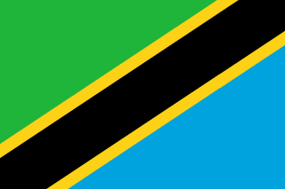
The flag image above is available in both raster and vector format. For a full-resolution download, right-click and save the linked file. Map links open in your preferred mapping provider so you can zoom into specific regions or plan a route. For deeper terrain and elevation data, our geographic resource library collects the best free atlases.
About this profile
This page is one of 250 country profiles on MapVista. The structured facts are sourced from open datasets that aggregate official records — see our methodology for the full list of sources and how we handle disputes, succession, and edge cases. The narrative paragraphs are written to give context to the numbers, but the figures themselves are not invented; if a value is missing it is shown as a dash rather than a guess.
If you spot an out-of-date figure or a misclassification, please reach us via the contact page. We refresh the underlying dataset regularly and corrections are applied at the next rebuild.